
Market
About
Painswick
Painswick is Barrie's southeast corner, and it is where a budget tends to go furthest. Detached homes from the 1990s in the north and the 2000s in the south, a library branch and a Zehrs at Yonge and Big Bay Point, and a longer run to Highway 400 than most of the city.
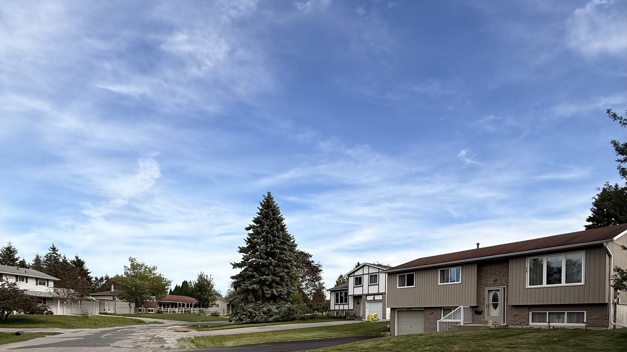
What Painswick is actually like.
Painswick is the answer when the numbers do not work anywhere else. It sits in the southeast corner of the city, east of Yonge Street, and because it is further from the highway than the west end, the same money generally buys more house. That is the trade, and it is worth being clear-eyed about both halves of it.
The housing splits by age. Census-derived figures for the northern half put it at 65% single-detached with 48% built between 1991 and 2000; the southern half is 74% detached with 49% built between 2001 and 2005. Row houses make up about a quarter of the north, which is where some of the more affordable entry points are.
There is more here than a subdivision. The Painswick branch of the Barrie Public Library is at 48 Dean Avenue near Yonge and Big Bay Point, with a computer lab, children's and teen areas and free parking. The Spirit Clock, a 34-foot sculpture that moves on the hour, stands at Yonge and Madelaine.
Schools in and around Painswick.
These are the schools in and near the neighbourhood, with the board each one belongs to. They are not a catchment list. Both boards set attendance areas by address and both say plainly that boundaries change, so confirm your specific address with the board before you let a school decide your offer.
- Willow Landing Elementary School330 Big Bay Point RoadSCDSB · JK–8
- St. Michael the Archangel Catholic School349 Big Bay Point RoadSMCDSB
- Mapleview Heights Elementary School180 Esther DriveSCDSB · JK–8
- Trillium Woods Elementary School20 Elmbrook DriveSCDSB · JK–8
- Assikinack Public School226 Little AvenueSCDSB · JK–8 · On the northwest edge.
- Maple Ridge Secondary School225 Prince William WaySCDSB · 9–12
Playing fields, and how close the water is.
- Painswick Park, 231 Ashford Drive — 9.7 acres, redeveloped in 2023. Accessible playground, lit baseball diamond, full soccer pitch, lit tennis courts and four dedicated pickleball courts.
- Huronia North Park, 311 Huronia Road — 29.1 acres with nine mini soccer fields, playground and wooded areas.
- Madelaine Park, 90 Madelaine Drive — 6.6 acres with a baseball field, playground, walkways and a small woodlot.
- Sandringham Park, 101 Sandringham Drive — 22.4 acres with baseball, basketball, soccer, tennis and pickleball.
- Barrie Public Library, Painswick branch, 48 Dean Avenue — near Yonge and Big Bay Point, with a computer lab, children's and teen areas, a community room and free parking.
How close you are to the water depends which part of Painswick you are looking at. From some streets it is genuinely close — Tollendale is right down the road and backs onto the water. From the newer streets further inland, getting to a beach is a drive rather than a walk. It is worth working out street by street rather than neighbourhood by neighbourhood, and it is one of the first things I would go through with you.
Where you'd shop.
- Zehrs — 620 Yonge Street, at Big Bay Point Road
- M&M Food Market — 190 Minet's Point Road
- LCBO — 461 Big Bay Point Road
- Metro — 640 Mapleview Drive East
The Zehrs at Yonge and Big Bay Point is the everyday shop for most of Painswick. The Metro that opened on Mapleview Drive East in 2025 is the other realistic option.
Where you'd eat.
- St. Louis Bar & Grill — 350 Big Bay Point Road
- Barnstormer Brewing + Distilling — 384 Yonge Street
- Scotty's Restaurant — 636 Yonge Street
- Tahini's Restaurant — 642 Yonge Street
- Gibby G's Breakfast — 489 Yonge Street
- Wimpy's Diner — 279 Yonge Street, Unit 2
- Debb's Place — 352 Huronia Road
The highway, and the commute.
Highway 400 access: Mapleview Drive, Exit 90, or Essa Road, Exit 94 — both a longer run than from the west end, because Highway 400 is on the far side of the city.
This is the honest part. Highway 400 runs down the western edge of Barrie and Painswick is in the southeast corner, so you cross the city to reach it. Barrie South GO on Yonge Street is the better option from here — Yonge runs straight through the neighbourhood to the station, and it is one stop closer to Union than Allandale. If you commute by train, Painswick works well. If you commute by car down the 400 every day, look hard at the drive before you buy.
On drive times
I have deliberately not published minute-by-minute drive times here. They depend on the hour, the season and which end of the neighbourhood you are in, and a number that looks precise on a website is worse than no number at all. Ask me and I will tell you what the drive is actually like from the street you are looking at, at the time you would be doing it.
About Painswick.
Why are houses cheaper in Painswick?
Is Painswick good for commuters?
What schools are in Painswick?
Does Painswick have a library?
Thinking about Painswick?
Tell me which streets you are looking at and I will tell you what is actually selling there, what the drive is like at the hour you would be doing it, and what any work the house needs is likely to cost. A real answer within 24 hours.
Other Barrie neighbourhoods: Ardagh Bluffs · Downtown Barrie · South Barrie · Holly · Barrie's East End